The Iberian Peninsula lies between the Atlantic and the Mediterranean Seas. Muslim rule in Al-Andalus after 711 CE gave the peninsula links to the eastern maritime world beyond the Mediterranean, through trade on the Red Sea, the Persian Gulf, and the Indian Ocean with its link to Indonesia and East Asia through the Strait of Malacca.
With the rapid expansion of territory under Muslim rule in the 7th century, and the expansion of trade and urbanization in the succeeding centuries, the Muslim lands acted as a hinge between east and west, linking the waterways and intercontinental land routes across Afroeurasia, and bringing them to Europe’s doorstep.
Across these routes, a wealth of knowledge concerning maritime travel flowed. Navigation is a term that describes shipbuilding and sailing techniques, as well as knowledge of plotting a course at sea, reaching the destination, and passing on the knowledge of the routes. As in many other fields, Arabs and Muslims of the eighth century to the 15th century CE had access to the pre-Islamic knowledge of many civilizations, and accumulated knowledge and technology during the Islamic era. Their constantly renewed contact with mariners in the Mediterranean region and the Indian Ocean provided the opportunity to stay abreast of new inventions.
Knowledge and technology needed for maritime travel belonged to several categories. The first requirement was knowledge that there were lands to which mariners could sail. This is not a minor matter in an age when some thought ships going over the horizon would sail over the edge of an abyss, or into the maw of sea monsters.
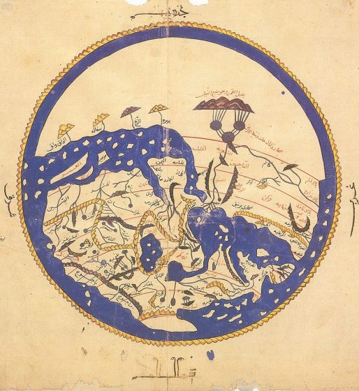
Knowing the topography of the lands, their inhabitants (not creatures with dog-like faces in their stomachs, for example, but ordinary human beings), and most important for the motivation to go there — what natural resources and manufactured products could be gained by sailing there. Surveys of geography fulfilled this requirement — detailing the mountain ranges, coastlines, harbors, cities and towns, and products, as well as the languages and customs of the people.
Geographic surveys were compiled by prominent writers from the ancients whose work was translated into Arabic, from the pre-Islamic Arabs of Yemen, Oman and the Persian Gulf lands whose maritime experience was already centuries old, and then early Muslim geographers such as Yaqut, al-Mas’udi, and others picked up the thread with their own, wider exploration.
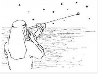
Early explorers of the Muslim lands also laid the groundwork for determining the location of places. Navigation is about getting from one specific location on the globe to another, by determining where the ship is at any given time. The most important technique for determining location is latitude and longitude. Muslims inherited this skill of reckoning using the stars and the sun in conjunction with fixed points on earth from the Greeks and other ancient peoples. The Arabs had relied on astronomical reckoning even traveling through the trackless deserts. Basic techniques, from fingers held up to the horizon to a simple card and string, could determine latitude with fair accuracy, combined with other knowledge of currents and landmarks.
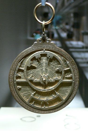
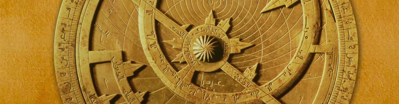
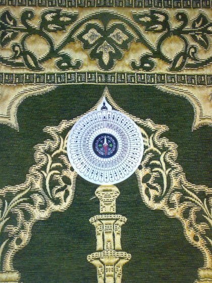
More sophisticated instruments used to triangulate position based on the sun, stars, and horizon were the quadrant, a quarter circle marked with gradations and a dial, and the astrolabe. The Greeks invented the astrolabe, and historians of science agree that the Arabs perfected it, from the 8th century CE on. Advances in astronomy and in mathematics made it possible, including use of Arabic, or Hindi, numerals to represent digits, and trigonometry, formulas dealing with the mathematical relationships of the sides and angles of triangles.
The magnetic compass is an invention whose origin is uncertain, but which seems to have moved from China along the land and sea routes toward the west. It was originally a lodestone or magnetized metal floating in a bowl of liquid used to show direction. The Chinese oriented it toward the south, and Indian Ocean accounts describe a magnetized iron fish floated in a bowl, whose head would point south to show direction at sea. Dry-mounted compasses in which the needle rotates on a pin over a paper or inscribed compass rose to show direction may have originated in Europe, in Spain, Italy, or elsewhere. Historians today must base their ideas on written descriptions, which leave many gaps.
The craft of instrument-making also contributed, as most astrolabes and other instruments are made of brass inscribed with great accuracy. Islamic Spain was the pathway by which astrolabe technology entered Europe from the 12th century, and it became so famous that the French scholar and translator Adelard of Bath named his child Astrolabe! The English writer Chaucer also wrote a treatise on the astrolabe. The astrolabe could be used for navigation at sea and surveying on land, determining depth or height of distant objects.
Another important aspect of finding location involved recording places in detail using their coordinates. Mathematical geography also used such instruments to plot locations and so to be able to make more accurate maps. Islamic practice required mosques to be oriented toward Mecca (qibla). This led to a science of determining direction on land with great accuracy. There were books written detailing the coordinates of cities, and charts showing the orientation toward the qibla. Just as Muslim scientists made it a priority to determine accurate time for religious observances, direction was equally important. Determining longitude at sea was much more difficult, and awaited the use of mechanical clocks combined with astronomical readings during the 18th century.
Portolan charts and pilot charts contained valuable knowledge that allowed mariners to navigate to and from their destinations. Pilots, or sea captains, traditionally passed down orally the knowledge of directions needed to get from one place to another by sea. Muslim mariners collected and published this information in nautical manuals called rahmani that scholars study in detail today to identify earlier place names visited and sea routes used to get there. Pilots had knowledge of currents, depths of water, shoals and rocks, and the shape of headlands from sea, very much like Mapquest® driving directions today. This is an example from the 10th century text of mariner Sulaiman ibn Ahmad al-Mahri (ca. 917 CE):
“The journey from Sundib and Farandib to Shati Jam is [made in the direction] ESE; from Shati Jam to the island of Zanjiliya is due south and from Zanjiliya to Najirashi, SSE. From Najirashi to Martaban is ESE. And from Martaban to Tawahi, SSE; and from Martaban also to the island of Fali, due south. From Fali to the island of Buttum is due south and from Buttum to the islands of Pulau Sanbilan Malacca, SSE… and from Malacca to Singapur, and this is the end of Siam to the South, and there the Little Bear is 5 degrees [above the horizon]… and from Ayam to Bab-i-Sin on the coast at 17 ½ P.S. it is NE and from Bab-i-Sin the land turns around to the south as they have told us.”
Another famous navigator of a later period was Ahmad ibn Majid (b. 1432 CE), who wrote the Book of Useful Information on the Principles and Rules of Navigation in 1490 CE, whom some writers have associated with personally piloting Vasco da Gama from east Africa to India. What surely accompanied the Portuguese mariner, however, was knowledge of the seas, directions, and navigation that was current in the Indian Ocean, and in the libraries of the Iberian Peninsula where interested Spanish and Portuguese like Henry the Navigator could access it. They had been preceded in the Indian Ocean by the Ming admiral Zheng He, and by generations of indigenous (native) mariners.
Ship design and sailing technology was another important aspect of navigation. This included the design of the hull, the masts and rigging (sails and their control with ropes), and the steering devices. Among the earliest innovations to reach the Mediterranean Sea from the Indian Ocean was the lateen, or triangular sail. Before its introduction to Europe, ships on the Atlantic and Mediterranean used square sails that needed wind directly behind the ship. Lateen sails allowed tacking, or sailing back and forth with the wind at an angle to the ship.
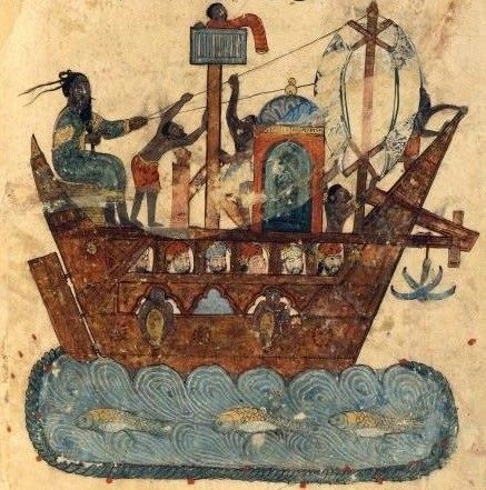
Combining triangular with square sails was one of the innovations that characterized the Spanish and Portuguese explorers’ ships of the 15th century CE and beyond. Another innovation that came from China by way of Muslim mariners was the stern rudder, a hinged steering board at the stern of a ship (shown in the image at right), which replaced an awkward oar lashed to the ship. The system is still used on ships today. Hull design was another innovation introduced through the Muslims’ connection with hemispheric waterways. It may have been modeled on the Arab “dhow,” a word of Swahili origin that lumps together many different types of seagoing Arab and Indian ships of the Medieval Indian Ocean.
What came to be called “carvel-built” hulls, in which the boards of the hull were attached side-by-side to the ribs instead of being “clinker-built,” or overlapping like the shingles on a roof, made ships sleeker, lighter and more maneuverable. Early modern shipbuilding, like navigation arts as a whole, did not spring fully formed from the minds of any one group, but evolved over centuries and millennia as the achievement of many peoples and many seas, just as the waters of the world were gradually knit together by the human desire to trade, explore, and travel over time.